

The drought of 2012 from a local perspective.
Drought has gripped much of our nation this year and Iowa has seen its full effect. Currently about 60%+ of the nation is experiencing some sort of drought conditions. The South, Midwest, and Western US has experienced the worst drought conditions this year. Some areas from Texas and points east have improved over the past few months, but the drought had persisted in those areas since 2011. As of October 2, 2012 the US drought monitor map shown in Figure 1 shows where the worst drought conditions are taking place. As you can see extreme and exceptional drought conditions cover much of the Midwest stretching from the Dakotas to Texas and as far east as Iowa, Wisconsin, Illinois, Kentucky and Tennessee.
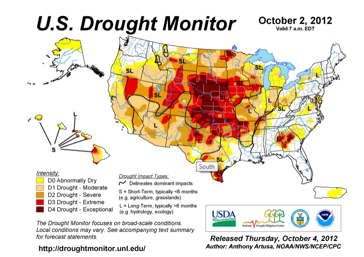
Figure 1
The impact on Iowa has been severe and with each passing day without rain the situation grows worse. The corn and soybean harvests where negatively impacted this year, but overall yields are not as bad as expected over Northern Iowa that saw some timely scattered rain over the summer. Some farmers got lucky, however if we have a dry winter and spring with the current drought conditions in place crops for 2013 will be in serious trouble. Burn bans have been in place in many Iowa counties this year with much of Western Iowa still in that situation. Water reserves for cites are being taxed and some folks with shallow wells have seen those wells run dry.
River and streams are running at historic lows and in some cases are dry. This has been and will continue to be stressful to wildlife and underground water systems if rains do not come in the next few months.
On October 1 my son and I went around to some of the rivers and streams near Madrid, IA so we could checkout the low water levels and take some photos of the dry conditions. I was surprised to see how low the Des Moines river was just west of Madrid. This is where Madrid receives its drinking water and I can understand why voluntary water restrictions are still in effect.
Here are some photos that we took of the low water conditions. We started at the Des Moines River just west of Madrid. We then traveled to just south of Ames to see the South Skunk River and finally ended our tour in Ames checking out Squaw Creek.
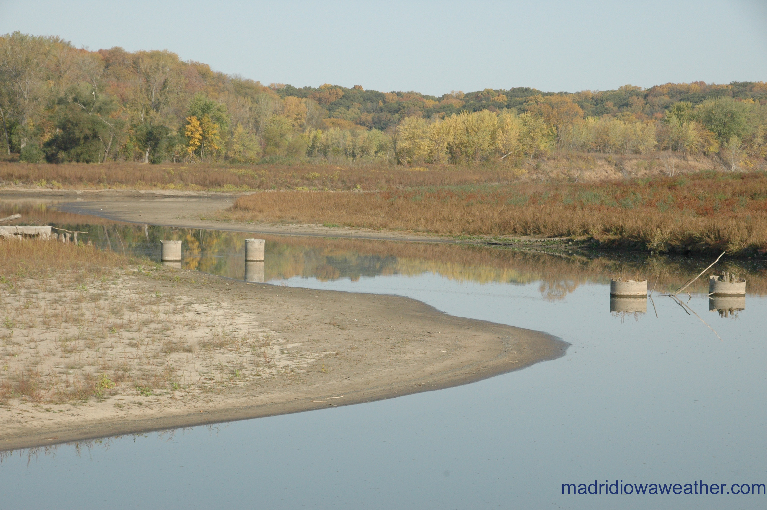
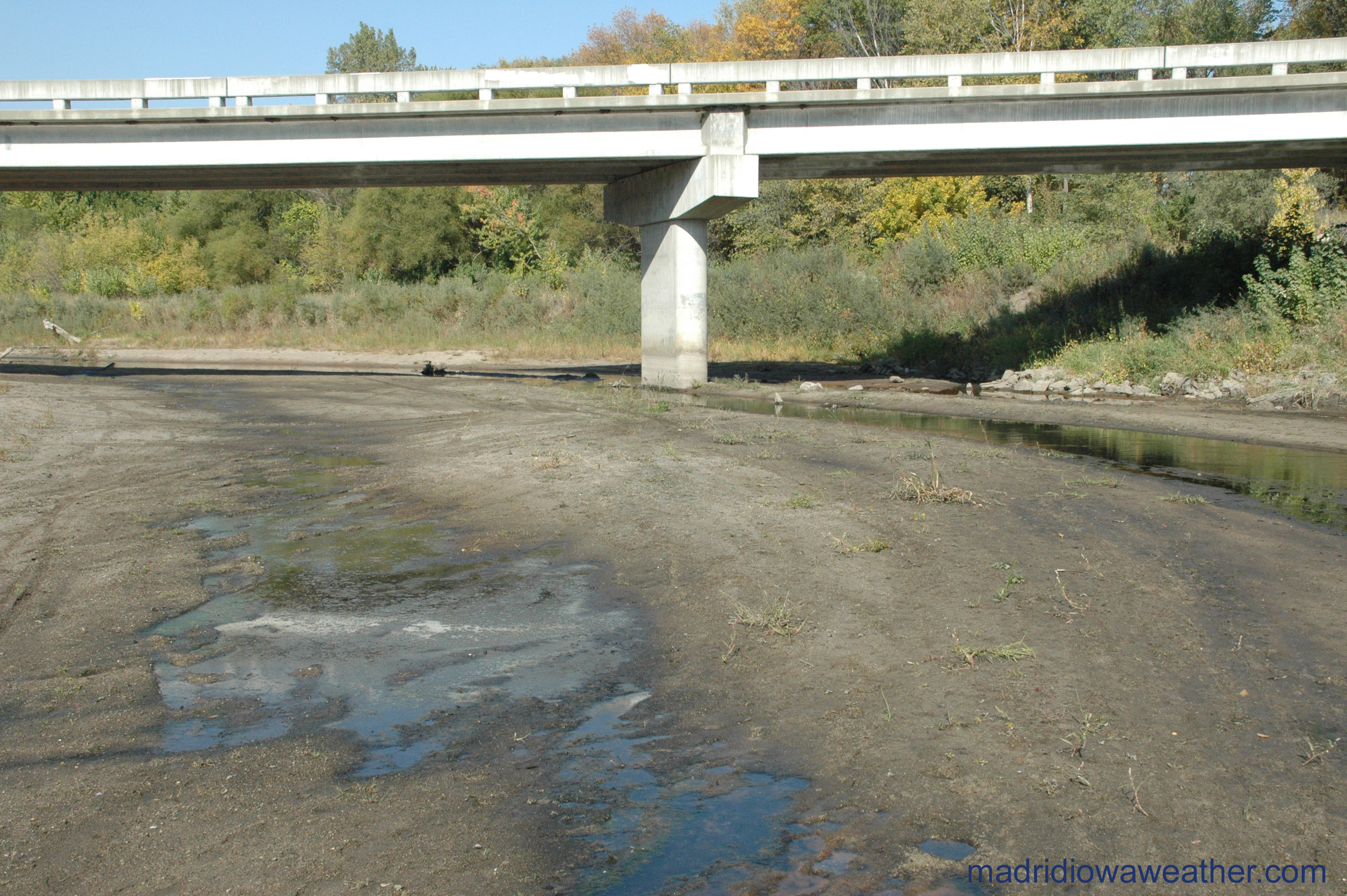
This first picture was taken along the Des Moines River just west of Madrid. Notice the water intake system visible because of the low water.
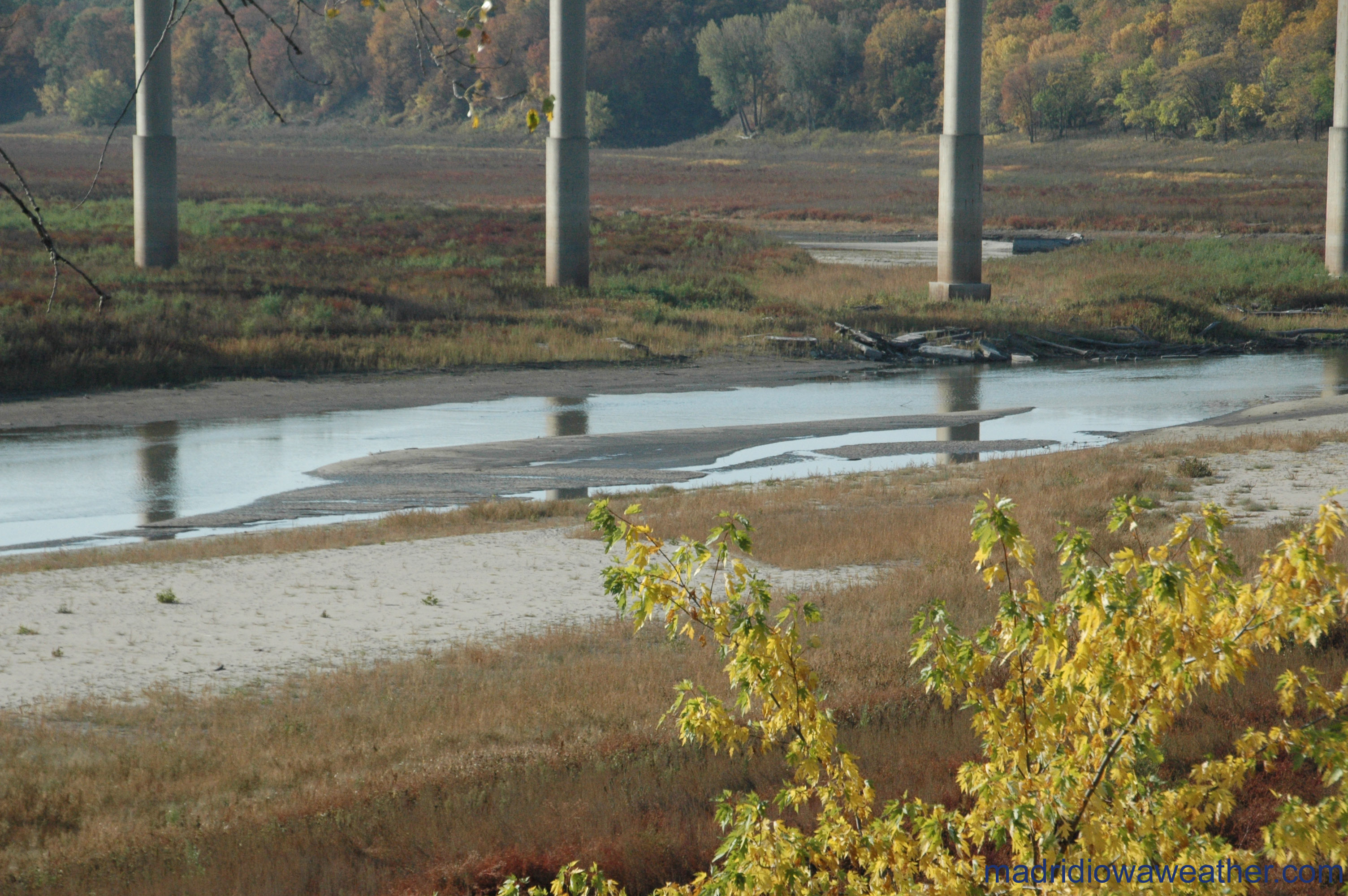
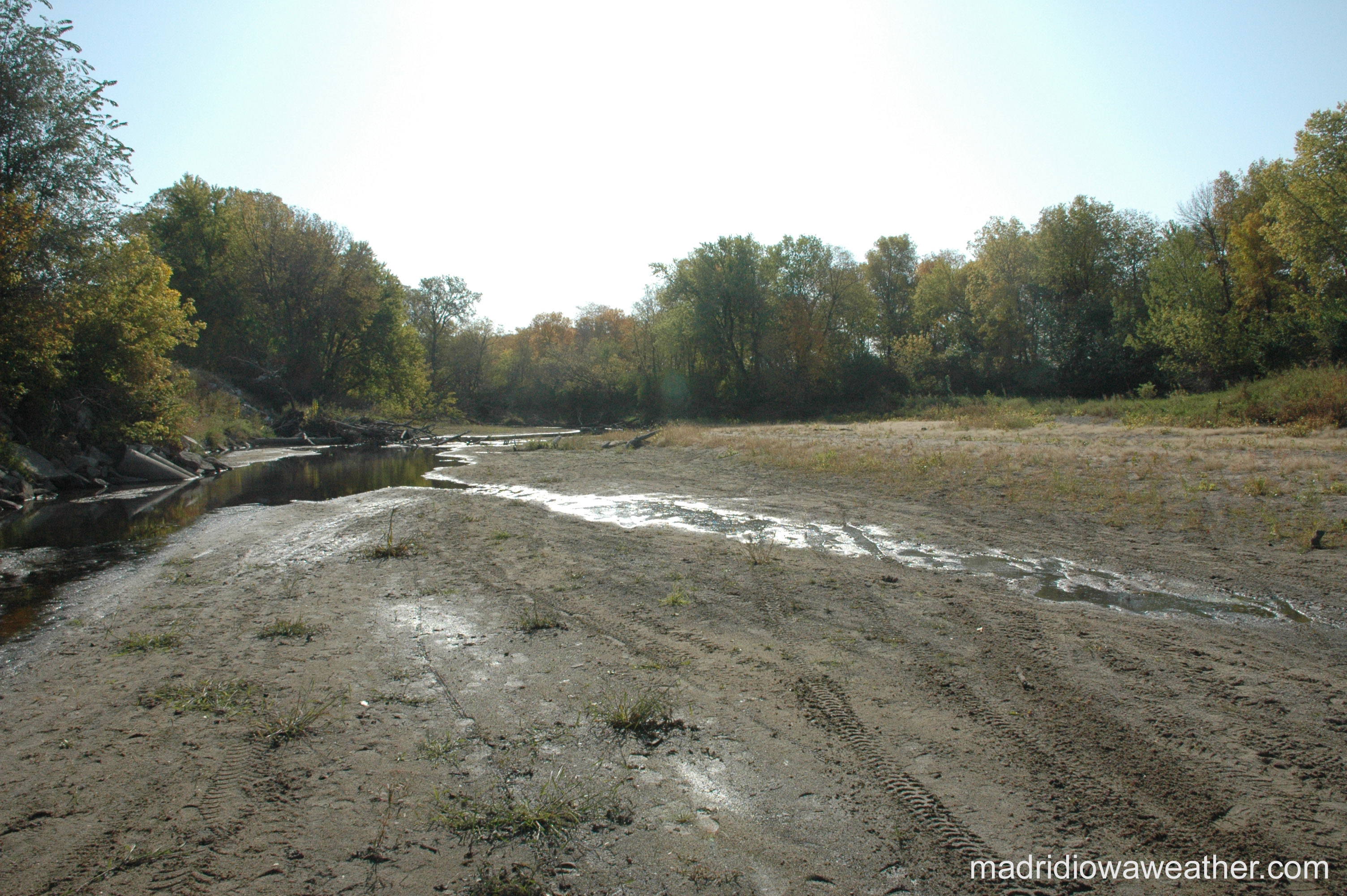
This next picture was taken off Highway 210 looking south towards the High Trestle Trail Bridge. I've never seen the Des Moines river this low since we've lived in Madrid.
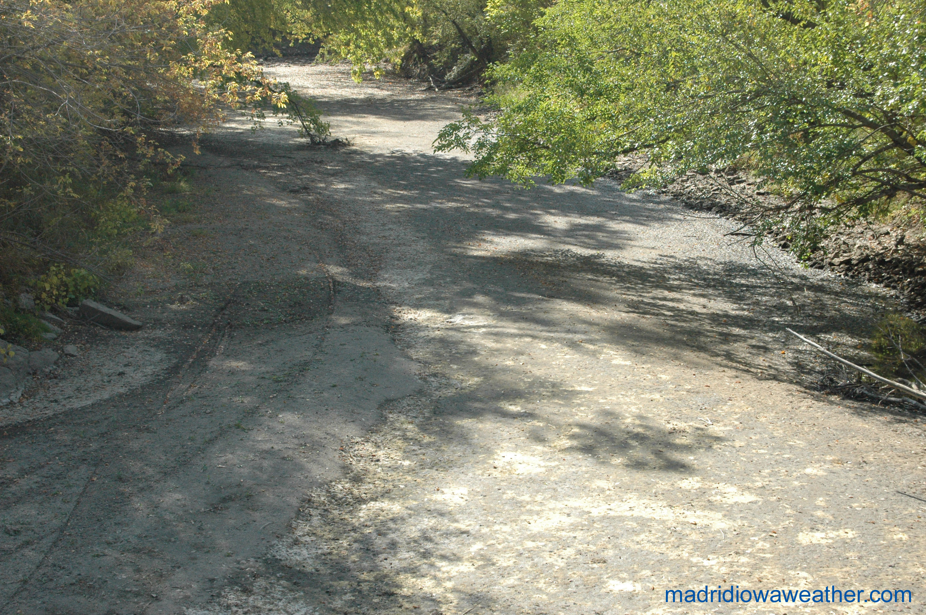
The next photo is of the South Skunk river just south of Ames. Not dry yet, but very little water.
South Skunk river again this time looking south.
The final picture is from Squaw Creek in Ames. No water flowing at all.